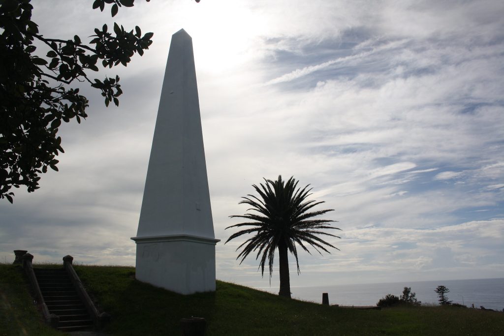
Built in 1850, the Obelisk in Newcastle stands on the site of the first windmill in the town which was built in 1820 to grind flour. The windmill itself became an important early navigational aid.
In 1819 Commandant Morisset ordered the building of the windmill ‘for the purpose of grinding flour’ and, in strong winds, was said to grind ’10 bushels of wheat per hour’, but as one of the highest points of the settlement, it was also used as a navigational aid by sailors.
The Government Flour Mill was superseded by newer mills further up the river in Maitland and Morpeth, and in 1847 the government decommissioned the mill and offered it for sale.
The shipping industry protested the sale as the windmill was considered an essential navigational aid, but the new owner moved quickly to demolish the windmill before the government could cancel the transaction.
However, continuing protests from shipping interests led to the NSW Government constructing the Obelisk in 1850.
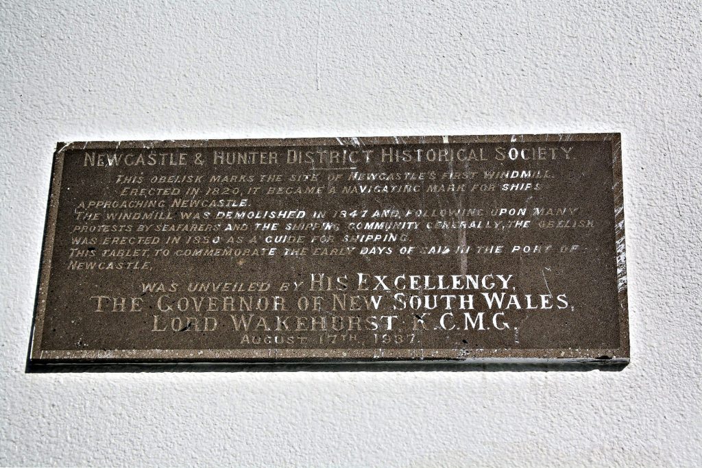
This is from an 1850 Government Gazette with instructions on entering the port:
Directions for Entering the Port of Newcastle.
“When the Obelisk is in with the tower by the light you are nearly off the rocks east-southerly of the Nobby’s; and when the Nobby’s is in with the same you are off the rocks north-west of the same.
“The Obelisk open to the west of the Queen’s Wharf will head you clear off the rock on the port land going in.
“The Obelisk open to the eastward of the Wesleyan Chapel will clear the Oyster Bank and the North Bank, and will lead in from twenty-four to fourteen feet of water as you approach the Oyster Bank on the starboard side going in, and from eighteen to twelve feet as you approach the North Bank, also on the starboard side.
MERION MORIATY, Port Master.”
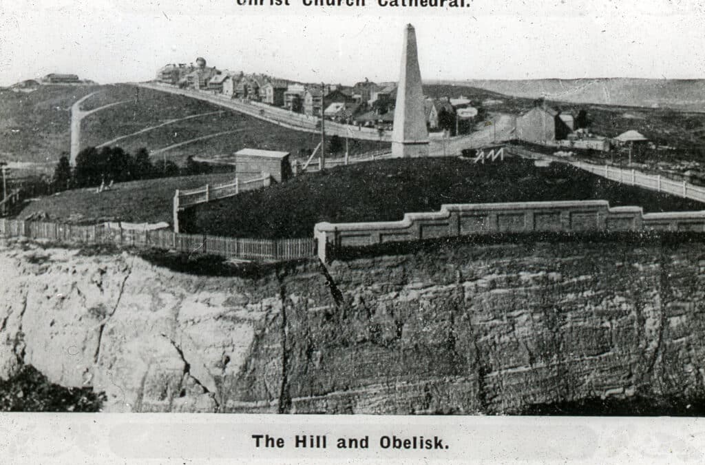
The hill the Obelisk is on also hides a water reservoir, but from the site you can see most of the region’s earlier water supply infrastructure – the reservoir on Brown & Tyrell Streets; on Shepherd’s Hill, there was another reservoir just north of what is now the Bar Beach car park; and of course the very important Walka Waterworks at Maitland which is still there and was the first reticulated water supply for the city of Newcastle bringing water into the city.
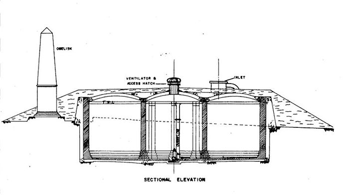
Plaques placed around the site also share a lot of information about the history of the supply of water to Newcastle.
The site has also been the site of a couple of serious accidents. In this 2012 interview, the City’s then-heritage strategist, Sarah Cameron, explains:
“In 1906, the pillars of old mine workings, probably workings of the Australian Agricultural Company, collapsed, leading to a ‘land creep’ across the hill,” said Sarah.
“This led to a commission of inquiry and the establishment of the Mine Subsidence Board as we know it today. If you can imagine under the surface the ground is like honeycomb from the mine workings. A lot of fractures occurred near the surface, and a lot of the houses in Tyrrell Street and Wolfe Street in The Hill were damaged.”
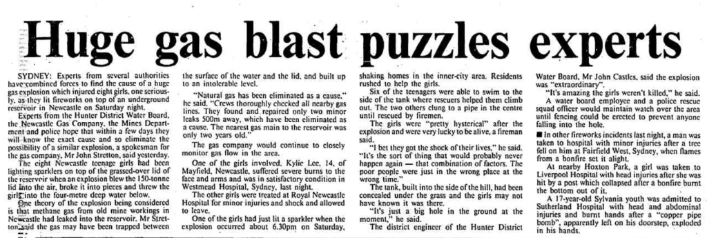
In 1985, a group of young girls (including Australian actress Susie Porter) playing with fireworks caused an explosion within the reservoir filled with gas escaping from corroded gas mains. One of the girls suffered serious burns. Susie shared her experience in a 2015 interview:
“At 14, hanging out by the beach in Newcastle, she and her friends were engulfed by a major gas explosion.
“We were on top of a big disused water tank, looking out to the Pacific Ocean. We were all lighting sparklers, we weren’t doing anything wrong, but we ignited the gas on top of this water tank and blew the whole thing up.”
The teenagers suffered second degree burns but no-one died. However, it’s not to be forgotten. Even now in her forties, Porter says: “If I’m at an outdoor restaurant or cafe and they turn on those outdoor heaters I get up and walk out of there.”
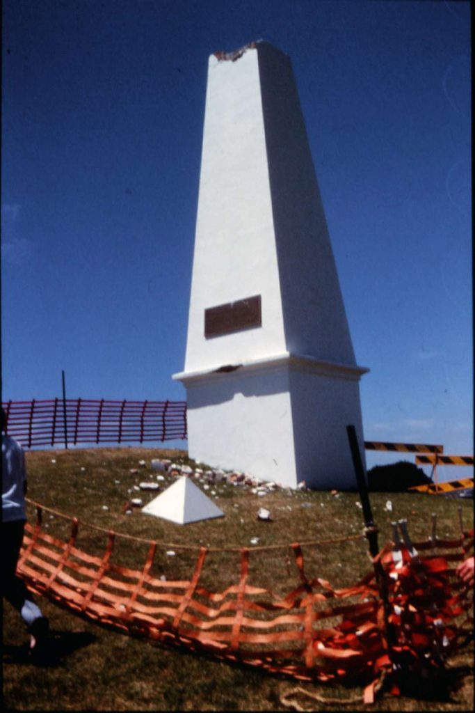
“In the 1989 earthquake there was the report of a home built on top of a 6-inch concrete cap over an abandoned mine shaft which had filled with water. The house imploded due to an apparent drop in the water table which left a vacuum beneath the concrete cap. The doors and windows of the house caved in and the owners grand piano got stuck in the hole. It’s a very unusual and serious incident but when you have a city with the mining history of ours, you are bound to have those sorts of incidents so the Mine Subsidence Board does a very important job today.”
Land creep was also a concern when Fort Scratchley was built. In 1881, construction of the fort came to a halt while ‘competent mining professionals’ were brought in to assess the site (which had been the site of the first coal extraction in Newcastle) and to consider the potential for the collapse of the mine workings under the site due to the weight of the construction and the percussive effects of the guns during firing.
“Around the 1860’s, the Grecian forms of structures like the Obelisk were quite popular,” Sarah adds. “It is rendered masonry and although repaired and rebuilt a number of times – including after the 1989 earthquake – it is still maintained by the city of Newcastle.”
Sarah says the park surround the Obelisk is a wonderful location from which to acquaint yourself with the city of Newcastle and the broader region, “The 19th century layout and plan of the town and it’s buildings is still clear from the 1830s, it hasn’t changed a great deal. Of course, a lot of the buildings have changed by the street grid, and the form of the town hasn’t.”

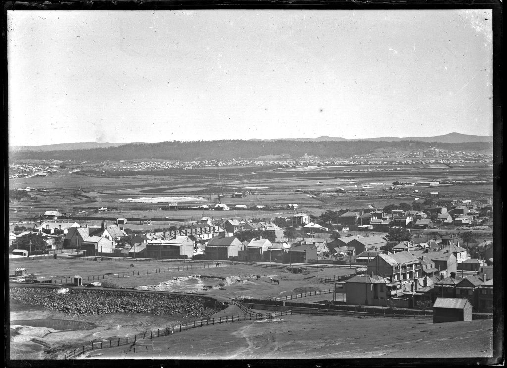
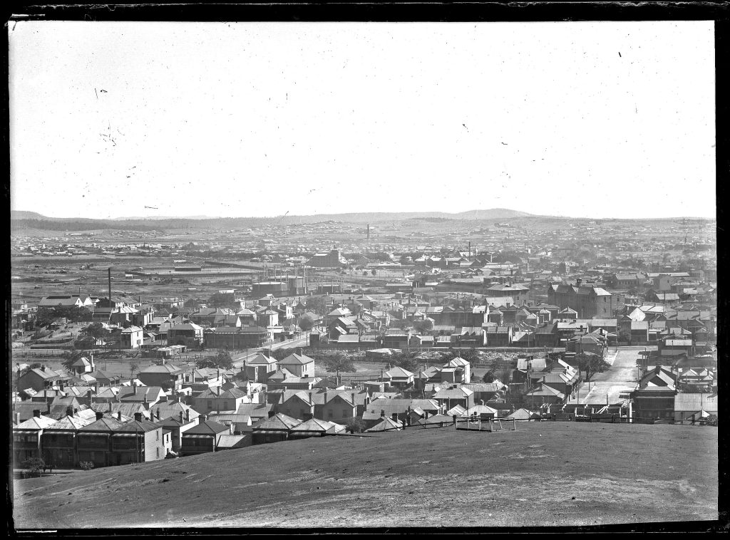
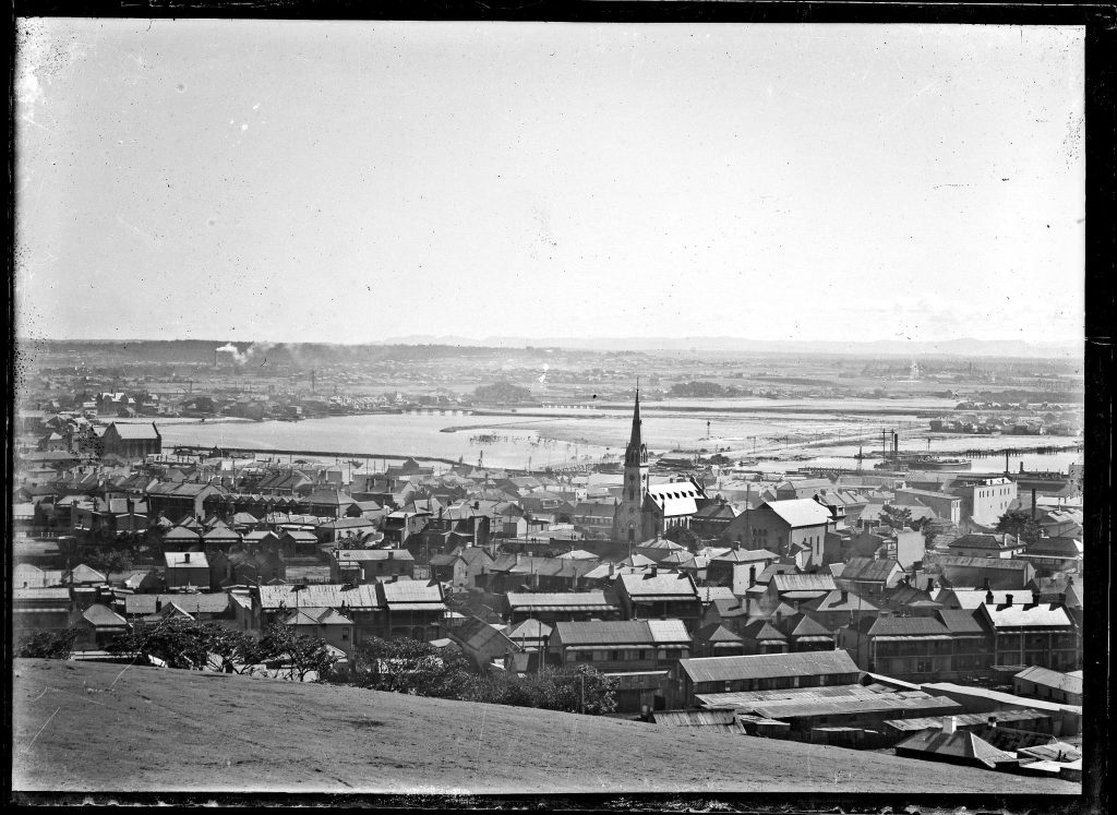
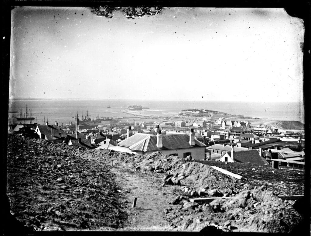
The Missing Piece
In 2021, the late Robert Rigby noticed that the three images produced a beautiful panorama of Newcastle, 1906, when placed together. He believed, however, that a fourth image was missing.
A retired academic in Melbourne had purchased a set of old glass negatives, and this set produced the missing piece of the panorama. Local historian Robert Watson put them all together.


Listen to the original podcast here:
Visit the Lost Newcastle shop





0 Comments